Multiscale Monitoring Tools for Managing Australian Tree Crops1
Trevor Parker (DAF), Assoc. Prof Andrew Robson (UNE), Stewart Lindsay (DAF) , Katelyn Ferro (DAF) & Moshiur Rahman (UNE)
Satellite imagery has long been utilized in agriculture for its ability to accurately map variability in crop health, vigour and for the prediction of yield. As a decision support tool, Normalised Difference Vegetation Index (NDVI) created from satellite imagery, has been used for over 20 years in broad acre farming. Currently, in the banana industry, the use of satellite imagery is limited.
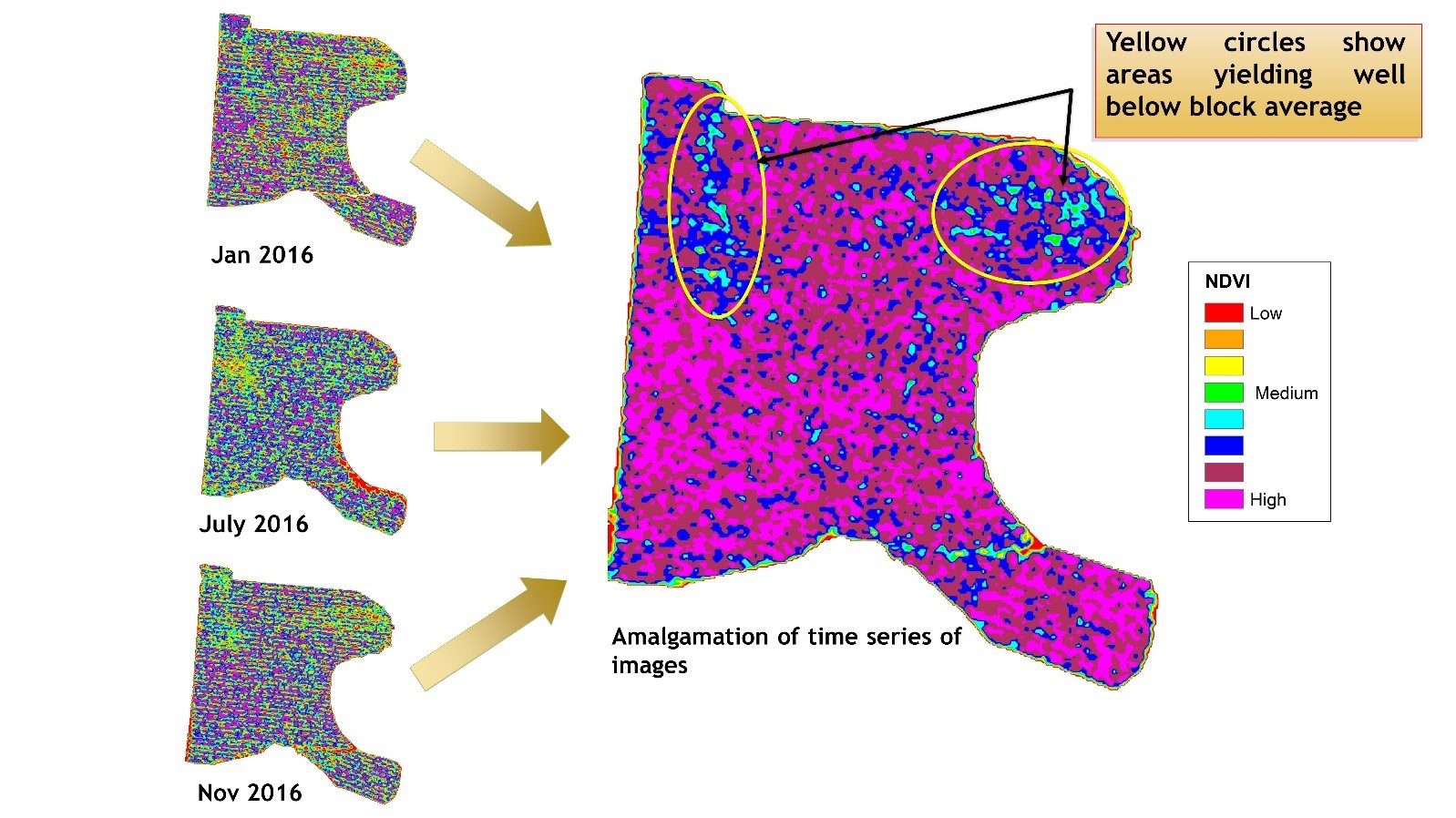
Worldview-3 (WV3) satellite imagery was evaluated for the potential of mapping productivity in banana plantations and therefore support improved production. WV3 imagery was chosen due to its spatial resolution (1.2 m pixels) and spectral resolution (8 spectral bands). NDVI images identifying variability in plant vigour were used to guide strategically located field sampling observations, in areas of high, medium and low vigour.
Unlike most other crops, banana plant growth and fruiting is continual, non-seasonal and is asynchronous resulting in banana crops having high levels of in-field variation. Variability is further complicated by age of plant, environmental influences and management approaches, providing challenges to untangle the message delivered from spectral reflectance.
This means a single one-off WV3 satellite image capture cannot reliably map variation due to productivity or stress alone. An amalgamation of a time series of WV3 images captured throughout the growing season overcomes the variation due to farm management practices and asynchronous growth to create a map of the true variation due to productivity. This approach allows identification of low performing areas for diagnosis and targeted management.
Where to next? Due to temporal and spatial resolution of WV3 imagery captures, individual plant productivity could not be reliably identified. Drone multispectral imagery is now being investigated for its potential to map individual plant yield, height, leaf nitrogen % and plant age.
This project is funded through the Rural R&D for Profit Program, managed by Hort Innovation with contributions from the Department of Agriculture and Fisheries and the Australian Government. Hort Innovation is the grower owned, not-for-profit research and development corporation for Australian horticulture.